Multimedia
Sea Surface Height Anomaly - February 22, 2016
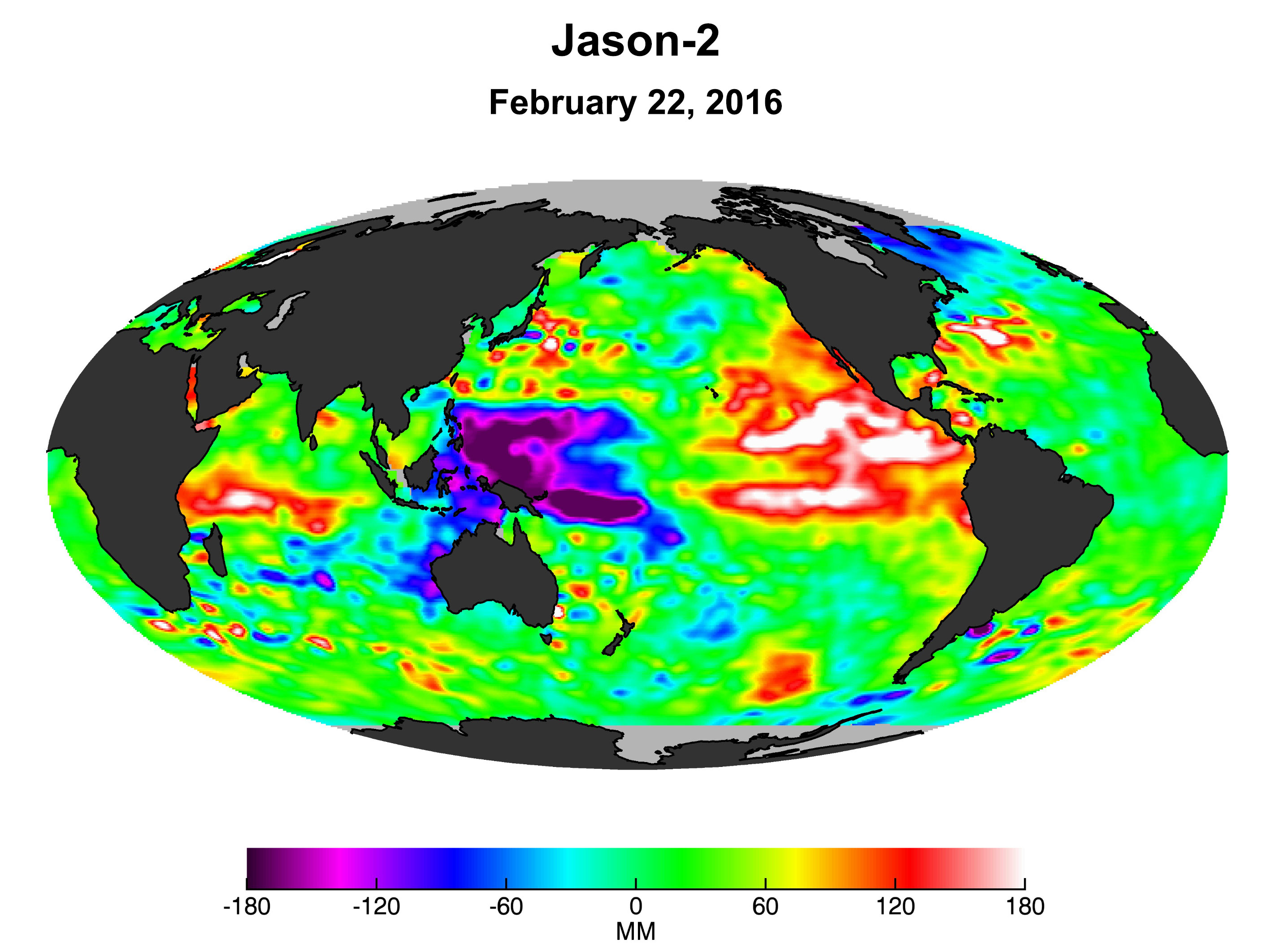
This image is from the Ocean Surface Topography Mission/Jason-2 satellite which uses radar altimetry to collect sea surface height data of the world's ocean. For more information see the El Niño/La Niña Observations page.
Credit
NASA/JPL